Monday, January 30, 2012

Bloody Sunday 40 Years On

Today is the 40th anniversary of Bloody Sunday, one of the most tragic days in all of Northern Ireland's 30 years of troubles and a watershed moment for increased paramilitary activity in the Catholic community's struggle for civil rights. A peaceful protest in Londonderry/Derry was blocked by British paratroopers who opened fire on the unarmed group of civilians. Dozens were injured and 14 men and boys died on that day, 9 of which were younger than I am today:

John (Jackie) Duddy (17)
Patrick Joseph Doherty (31)
Bernard McGuigan (41)
Hugh Pious Gilmour (17)
Kevin McElhinney (17)
Michael Gerald Kelly (17)
John Pius Young (17)
William Noel Nash (19)
Michael M. McDaid (20)
James Joseph Wray (22)
Gerald Donaghy (17)
Gerald (James) McKinney (34)
William Anthony McKinney (27)
John Johnston (59)

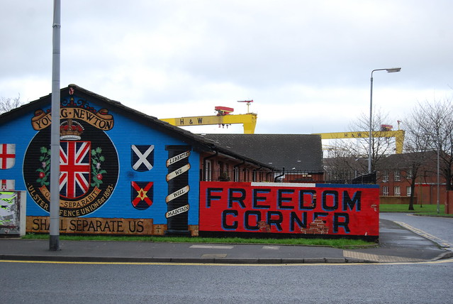
Just over a year ago, nearly 40 years after the incident, an state investigation in Britain revealed that the facts of Bloody Sunday which had previously been that the killings were warranted and that the army was fired on first. PM David Cameron apologized to the people of Derry on behalf of the country and the armed forces.

Apology from PM David Cameron

Response from MP Mark Durkin

Dramatic film portraying the events of Bloody Sunday

Saturday, January 28, 2012

Newtownards Road Tour


I've been to East Belfast and described the murals in the Protestant Newtownards Road and the Catholic Short Strand. This time I got an insider's tour of the area with a local from the Upper Newtownards Road. Everywhere along within the Protestant East Belfast community you see the colors red, white and blue from the Union Jack painted on almost ever wall, telephone boxes, light poles, and even the curbs as seen above. Pride for the United Kingdom runs high along this road and it seems to gain in intensity along the border with the Short Strand.


Many of the murals in the area relate to the UVF/UDA paramilitary background in the area that "defended" the protestant community from attack by the IRA. However, there are also a number of murals relating to the tragedies of the past and the industrial history in the area. From most places in the neighborhood the H & W cranes loom large over the social housing communities where generations of working class Belfast families live. Because this area is so heavily working class, unemployment is relatively high and many shops even along the main streets have closed their doors and fallen into disrepair.


However, a community regeneration initiative called the East Belfast Partnership has begun construction of two new construction projects at the core of the community and have improved the sidewalks and public realm along a portion of the street to encourage shopping and economic activity.

Thursday, January 26, 2012

Stormont Grounds tour


Another classmate of mine who lives in East Belfast offered to take me around to some of the most important local places to see. The first part of my tour was to the area of Stormont which is the local government building for Northern Ireland. The use of this building has a tumultuous past in Northern Irish history as the seat of a Unionist government until the beginning of the troubles which repressed the Catholic population of the province. After being shut down for a short time during a period of direct rule from Westminster (London), it was reopened and eventually became the seat of representatives (MP's) from both communities. Primary parties include the UDP for Unionists, Sinn Fein for Republicans and Alliance as a Center option among many others. The power sharing agreement requires representatives from both communities to be in parliament to ensure civil rights are granted to all residents of the north.

Government official being interviewed in front of Stormont

Aparently, during WWII when Belfast was being blitzed by the Nazi Luftwaffe the entire building was painted black to hide it from the airplanes flying overhead at night. The discoloration along the pediment of the building is said to be a remnant from that time. 

The area surrounding the building to the right and left of this image is a park of wooded trails.

More photos of my East Belfast tour will follow in the coming days...

Tuesday, January 24, 2012

Newcastle Roadtrip


A wonderful classmate of mine took me for a trip along the east coast of Northern Ireland along the Irish seaside town of Newcastle. Along the way we stopped to snap some photos of the Irish sea between Northern Ireland and Scotland. There are brief areas along the horizon that the Scottish hills can be seen, but the cloudy sky didn't help visibility. The auburn and green vegetation along the slope toward the water is beautiful right now with all the rain.


Monday, January 23, 2012

Terror threat on high alert in L/Derry

On Thursday night a flashback to the awful bombing campaigns of the troubles place Northern Ireland on high alert for terrorist activity. Two bombs were detonated in Londonderry/Derry that night by dissident republicans who oppose the long established peace process on the island. One of the bombs went off near the tourist information center, which seems reckless because the groups target could not have been tourists themselves. Nobody was hurt because a warning call came in only thirty minutes prior to the explosions. Had anything gone wrong many innocent people certainly could have been injured.

This sculpture of young men from both sides reaching across the river for peace represents the city's goals

Saturday, January 21, 2012

Visit from the US Ambassador to the UK

Ambassador Louis Sussman (middle) spoke to a group in the Great Hall at Queen's on Thursday

On Thursday evening I had the privilege to listen to the US Ambassador to the UK support the work of Queen's University and continued in life after the troubles in Northern Ireland. At the end of his presentation I was even able to show my support for the Fulbright program, which he mentioned numerous times in his speech, as well as privately funded programs like the Rotary Ambassadorial Scholarship. These two programs deliver immense amounts of important diplomacy all over the world and have been invaluable, life changing experiences for me on social, academic, and personal levels. If you are interested in hearing more about what Ambassador Sussman had to say you can read it in this press release.

Friday, January 20, 2012

Location of Interface Walls

Map of religious identity based on Census Data
The map above demonstrates the clear cut separation between religious identities in greater Belfast. The dark green colors represent almost entirely Catholic neighborhoods while the dark red represents almost entirely Protestant neighborhoods, while the yellow represents mixed areas.

Diagram by Forum for Alternative Belfast

The second diagram is slightly zoomed in from the above map (notice the scale of the Lagan River in the right side of the page), but the red lines represent the existing "peace walls" or interface walls separating neighborhoods around the Belfast City Centre. The dark grey and black forms represent divisive urban forms such as vacant land, the Westlink Motorway curving around the north and west portion of the City Centre, the M3 motorway on the right side, and main arterial routes surrounding the core of the city.

As the maps above demonstrate, the primary fragmentation of Belfast's landscape occurs along the north and west portions of the city on the other side of the motorway and on the east side of the Lagan River opposite the City Centre. There is a territorial psyche that has developed in these neighborhoods that feel marginalized into homogeneous 'ghettos' along the outskirts of the city. The desire to claim territory through nationalist sentiment on murals and protection through peace walls is most prevalent in these areas and represent the fear (whether real or imagined) the residents perpetually live with.

Wednesday, January 18, 2012

Funding for Peace Wall Removal

The International Fund for Ireland has set aside £2 million in an attempt to remove the "Peace Walls" or interface walls that separate Protestant and Catholic communities throughout Belfast and other areas in Northern Ireland. The funding will first fund cross-community groups who will begin the dialogue of living without the boundaries and then will consider supporting capital projects such as a shared community space where contacts could develop, which is exactly the kind of work I am interested in.

Famous Peace Wall along Cupar Way in Belfast
According to the article there are 42 "Peace Walls" that still exist in Belfast but other reports have claimed as many as 88 standing peace walls in the city. At the time of the ceasefire in 1994 there were only 29 walls throughout the city. Despite the ceasefire, Good Friday Agreements, and political steps taken since that time the interface areas between communities have been built up even further.

Thursday, January 12, 2012

Population shifts in West Belfast

The Protestant/Unionist population along Shankill Road has dropped from approximately 85,000 at the beginning of the Troubles in the early 1970's to approximately 30,000 today. Meanwhile, the Catholic/Republican population along the Falls Road has increased substantially. These trends seem to be consistent throughout the urban area of Belfast. Protestant communities continue to move outward toward edge of the city and the suburbs while the Catholic population as a whole is rising.

View along the busy Falls Road

Tuesday, January 10, 2012

"Walls of Shame"

Sorry about the long pause between posts. I am in the midst of final project time and the past few weeks of the holiday season were spent in the US with friends and family.

I stumbled upon this Al Jazeera series that discusses the history of the walls dividing communities in Belfast. Part one and two can be seen below. Within the video the areas of Short Strand and Shankill Road were highlighted.

Part 1

Part 2