 |
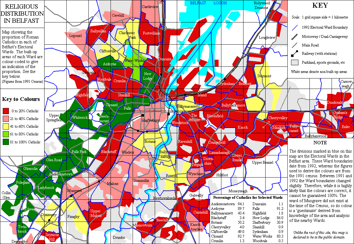
| Map of religious identity based on Census Data |
 |
| Diagram by Forum for Alternative Belfast |
The second diagram is slightly zoomed in from the above map (notice the scale of the Lagan River in the right side of the page), but the red lines represent the existing "peace walls" or interface walls separating neighborhoods around the Belfast City Centre. The dark grey and black forms represent divisive urban forms such as vacant land, the Westlink Motorway curving around the north and west portion of the City Centre, the M3 motorway on the right side, and main arterial routes surrounding the core of the city.
As the maps above demonstrate, the primary fragmentation of Belfast's landscape occurs along the north and west portions of the city on the other side of the motorway and on the east side of the Lagan River opposite the City Centre. There is a territorial psyche that has developed in these neighborhoods that feel marginalized into homogeneous 'ghettos' along the outskirts of the city. The desire to claim territory through nationalist sentiment on murals and protection through peace walls is most prevalent in these areas and represent the fear (whether real or imagined) the residents perpetually live with.
No comments:
Post a Comment