Friday, December 16, 2011

Belfast Markets


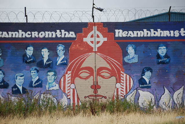
As I prepare to depart for an extended holiday recess in Wisconsin I leave you with pictures from a recent journey I took to the St. George’s Market as well as the Christmas Market set up outside of the City Hall. A selection of international foods and gifts are available in both locations (I highly recommend the pig roast stand which offers a baguette with stuffing, pork, and thick gravy). The beer tent also offers massive steins of lager, flavored beer, or even a 14% ABV beer that actually tastes more like syrup. The Christmas Market is lively by day and night.


St. George’s Market is open all year round and is especially busy on the weekends when a live band plays at the center of all the shops.


Sunday, December 11, 2011

Riots at Ardoyne


A famous flashpoint in West Belfast between Catholic and Protestant communities is Ardoyne, an area further west along the Crumlin Road. Holy Cross Church, shown above, is the primary Catholic place of worship in the area. The video below shows the height of the rioting season last July when Loyalists march toward Ardoyne under the banner of King William of Orange’s victory over Catholic King James at the Battle of the Boyne staking British claim to the island in the late 17th century.

The Crimestopper vehicles and riot police are out in full force to protect a clash between both communities.

Saturday, December 10, 2011

Crumlin Road Courthouse & Gaol


The Crumlin Road is a largely protestant district north of Shankill. Although few murals are visible from the road, the area is widely recognized for two monumental buildings at its core, the Courthouse and Gaol (Jail). Sitting directly across the road from each other, these mid-19th century buildings were both designed by the famous Belfast architect, Sir Charles Lanyon. However, these buildings are abandoned examples of his work and have been the site of degradation and controversy.


The old Crumlin Courthouse has a beautiful neoclassical facade that has warn substantially during decades of disuse. Fires, natural decay, and controversy over exactly what the building would represent if re-purposed has prolonged and worsened its ruined state.


The jail across the street has fared much better despite the more disturbing past, which you can hear more about in this video. There is supposedly an underground passage that connects the two buildings. Despite the fences surrounding the property due renovation work, the building is said to be open to visitors for tour, but I was not able to get in during my adventure on a Sunday. 

Sunday, December 4, 2011

Murals of North Queen's Street/Tigers Bay


Along the Eastern edge of New Lodge Road and extending further north out of Belfast is North Queen's Street. The two areas are divided by Alexandra Park which I mentioned in earlier posts as being a public park divided by a wall. That wall is  now opened during certain times to allow the communities to enjoy the entire park.


There is a high level of vacancy throughout many of these neighborhoods and the majority of that vacancy occurs along the fringe of the territories of particular religious association. The "peace walls" that divide communities often encourage a movement in each community away from the wall and toward the heart of the district.

Murals of New Lodge Road


In the new Rihanna video that I posted over a month ago, the New Lodge Road was the focus of "finding love in a hopeless place". An apartment building like the one above was the setting of a relationship doomed to fail due to drug addictions and violence.

The New Lodge Road is a low-income, primarily Catholic area that surrounds numerous towers like the one above, all of which are topped with a mural of a volunteer IRA member who died during the hunger strikes in 1981. On the walls of the surrounding gable ends of social housing complexes are murals telling the history and evolution of New Lodge.


In addition there are a number pleas for equal civil rights in an area that has felt underprivileged throughout their existence in the area.


Interface wall in East Belfast


Similar to the interface wall between the Catholic-Falls Road and the Protestant-Shankill Road in West Belfast, there is a tall fence separating the Catholic-Short Strand and the Protestant-Newtownards Road in East Belfast. However, this wall has no graffiti from international artists and is undoubtedly not a common stop for tourists in an open-top bus or black taxi.

This area was the site of a flare up in violence over the summer which was particularly noteworthy for the use of firearms. Usually these riots are limited to rocks and homemade missiles like Molotov cocktails, but a reporter was shot while filming the violence. Both sides pointed blame and claimed injury in this altercation that continued for a few nights.

Friday, December 2, 2011

End of Segregation?

Two recent Belfast Telegraph articles (1, and 2) have highlighted an effort by the "Democratic Unionist Party", which was originally founded in 1971 as the "Protestant Unionist Party", to encourage the end of division and segregation. One of the most concerning and surprising carry-overs from the Troubles in Belfast is the continuation of a segregated education system where Catholic and Protestant schools educated students of the same religious background.

Monday, November 28, 2011

Murals of Newtownards Road


Immediately adjacent to the Short Strand neighborhood is the Loyalist community along Newtownards Road. This area was the site of numerous days of violence over the summer during riots. There is a high density of murals in the area that say "Lest We Forget", referring to atrocities that were committed against the community by the IRA.


As seen in other Loyalist areas like Shankill Road or Sandy Row, the "Red Hand of Ulster" is a prominent symbol of Northern Ireland. Even the rugby team of Ulster has the Red Hand as their team symbol. Unfortunately, this symbolism has become synonymous with Loyalist paramilitary groups, namely the "Red Hand Commando's" who controlled this area of East Belfast.


Additionally, many of the area's murals relate to the industrial, working class population that has lived in this area for well over a century. As you can see in the image below, the shipbuilding harbor is very near to this neighborhood and many former employees of Harland & Wolff would have lived and worked here. They've shown their pride for their industrial past on the walls in the area as well.


Sunday, November 27, 2011

Murals of Short Strand


Immediately east of the Lagan River and south of the industrial port district is an area known as Short Strand. This social housing complex is inhabited by primarily low-income Catholic families adjacent to a loyalist community along Newtownards Road, which I will show you in my next post. The first sign that this neighborhood is Republican can be scene on the entrance gate pictured above, where English and Irish are side by side.


A community center, sports facilities, and a youth empowerment scheme seem to be efforts to move the residents of this neighborhood in the right direction, but the facilities are run down and the area remains isolated between Loyalist communities and multi-lane roads. 


Politically motivated murals cover walls around the housing complex supporting the vote for a Sinn Fein and the paramilitary organizations that once controlled the area.


Murals of peaceful times and atrocities committed against the population can also be seen on the walls. The Palestinian flag in the image below represents the nationalist feeling that British control over the north is an occupation, just as Israel is to the Palestinian territories.