Saturday, April 30, 2011

Photo of the Day - "Protests for Syrian Regime Change in Cyprus"


Chants for the fall of Syria's president Bashar al-Assad could be heard from blocks away yesterday as a group of a few hundred peacefully demonstrated on the streets of Nicosia to call attention to the killings that have occurred in the neighboring countries across the Mediterranean over the past few weeks.

Friday, April 29, 2011

Calling for... Buses?

"Give us buses... not cathedrals" with a stencil of the archbishop?

I found this graffiti the other day while exploring an are within the Old City near the Buffer Zone that is undergoing facade restoration. Surrounding a stenciled cartoon of the Archbishop of the Cypriot Orthodox Church is a call for buses rather than new cathedrals, which I assume to be directly referring to the church's current plans to build a 26 m. (85') tall cathedral at the core of the Old City and indirectly referring to the incredible wealth owned by the church. The height of this brand new neo-byzantine style temple would dominate the skyline of the historic core of the Old City, including the Selimiye Mosque (formerly St. Sofia Cathedral), the minarets of which currently rule the airspace within the walls. Not only would this monstrosity completely detract from the heritage and unique urban fabric within the historic city walls, but I (and many others I've spoken with) fear this would begin a sort of building war for the tallest religious structure in the capital between the two sides of the Buffer Zone. Additionally, there are already 7+ historically significant churches within the Old City and many other massive cathedrals that look just like this one in neighborhoods surrounding the walls. 

An elevation and a rendering found on the website of an organization of concerned citizens that live in the Old City called Awake Within the Walls 

Although the battle continues regarding whether or not the church should build the cathedral, and many argue the church can't be stopped even if they were denied their proposal because of their power, at least the municipality has responded to the cry for buses by implementing a new bus system called OSEL and by building a new bus station at Solomou Square on a bridge over the moat.

Construction of the bus station at Solomou Square

Wednesday, April 27, 2011

Annan Plan to Ban Plan?

Indecisive piece of graffiti in south Nicosia 

Seven years ago this month, the Annan Plan was voted on as a referendum that would have "settled" the Cyprus Problem prior to the island's accession into the European Union. The plan, proposed by former UN Secretary General Kofi Annan, would have created a two-state federation with a majority of "yes" votes from each community. The leadership of both sides at the time campaigned for a "no" vote while the international community was pushing for a "yes" leading up to the decisive vote. With nearly 90% of each population turning out to the polls, the Turkish Cypriot population voted 65% "yes" while the Greek Cypriot population voted 75% "no". My sources tell me there was a demonstration of approximately 2000 in North Nicosia yesterday calling attention to the Turkish Cypriot wish that a the referendum would have resulted in resounding YES... MAYBE a new proposal is looming as current UN Secretary General Ban Ki-Moon continues to push for peace talks with the leadership of both sides. Could a Ban Plan achieve the intended result?

Monday, April 25, 2011

An Orthodox Easter

Χριστός ἀνέστη! (Christ has Risen)

This weekend, I set out to experience Easter in the Cypriot Orthodox fashion. My adventure began on Friday afternoon with a tour of churches within the Walled City. I followed Nicosians from church to church as they kissed the Epitafio, which is a cloth that represents the body of Christ on the day that he was laid to rest. The cloth is set beneath a flower-laden altarpiece in the middle of each church and most lines extended outside the entrance. The narrow streets of the Old Town were packed with cars as the older generation was delivered from church to church.


Train of people walking from St. Kassianos church to Chrysaliniotissa church near my hostel

Queue to kiss the Epitafio

The beautiful garden of St. Kassianos church. The elderly caretaker continued to live next to the church and care for it daily throughout the war in 1974.

Queue at St. John's Cathedral next to the Archbishops library

St. Antonios church

Epitafio within Phaneromeni church

In the evening, I attended a service at Chrysaliniotissa church (one of the two churches in my neighborhood). Although I couldn’t understand very much of the service there was a long section that was printed and sung by the congregation with the priest leading the service which I assume was the story of the passion. The medieval church was packed full of people and the crowd extended outside the church under the surrounding portico and into the courtyard. At the end of the service, the high ranking church officials picked up the Epitafio and walked it around the church courtyard while singing as the entire congregation followed. As they came to a bottleneck on the north side of the church courtyard, the Epitafio was raised and every single member of the congregation walked underneath it.


Congregation underneath the portico listening to the service


Saturday night, I was invited to experience the rural Easter traditions in the village of Kyperounda. The late night service (which ended just after midnight) took place in the brand new cathedral that was built atop the village. Many hundreds of residents piled into the church shoulder to shoulder holding candles. At the end of the service, the lights went out and candle by candle the church (main level and balcony) was relit.

At the end of the service there was a massive bonfire immediately outside of the church where all the town’s residents gathered. We left from the bonfire for a Easter/birthday celebration that included the traditional cheese bread (Flaouna), soup, chicken, and wine.


Sunday afternoon I had an incredible lunch at Lord Kitchener’s Restaurant with some fellow Fulbrighters. Kitchener was a British cartographer who came to Cyprus not long after the British took control of the island in 1878. He was assigned with the task of completing a full topographical survey of the island as well as the main cities and his measurements are still used as a basis for the surveys taken on the island to this day. The restaurant includes his original residence on the island (which is now the bathroom of the establishment. The food was some of the best I’ve had on the island, although it’s not a traditional Cypriot menu by any means. The British chef and his Italian wife run provide incredible service and a wonderful seasonal selection of dishes and all kinds of fresh fish. If you come to Cyprus and are able to get to the village of Psematismenos, I highly recommend you stop in.


Lord Kitchener in a famous British recruitment poster: http://www.sterlingtimes.org/kitchener.jpg
Lord Kitchener's survey of Nicosia: http://www.moi.gov.cy/moi/DLS/dls.nsf/0/C625BA8CF9E17F85C2257123003953BB/$file/KITCHENER_Nicosia.jpg?OpenElement

Wednesday, April 20, 2011

Ledra Street Checkpoint

Between 1974 and 2003, crossing of the Buffer Zone between northern and southern parts of the island was extremely limited. For 30 years, the Turkish- and Greek-speaking populations of Cyprus were essentially sealed apart on their respective sides. Immediately preceding the 2003 referendum vote (also known as the Annan Plan, after UN Secretary General Kofi Annan), the Turkish Cypriot authorities eased the travel restrictions, allowing Cypriots to see the 'other side' of the island for the first time since the war. Since the original checkpoint was opened at the former Ledra Palace Hotel (now the UNFICYP headquarters and the site of many bi-communal discussions), six other Buffer Zone crossings have opened at various points across the island.

The only crossing within the Walled City is located on Ledra Street, the pedestrianized main commercial street, and was opened in 2008. Prior to the opening of this checkpoint (as you can see below), the street dead ended into the Buffer Zone, which for many years was used as a lookout platform for residents and visitors in south Nicosia to see into and across the division. 

Platform where Ledra Street dead ended into the Green Line along its southern boundary: http://en.wikipedia.org/wiki/File:Chypre-LigneVerte1.JPG

The Ledra Street checkpoint today

Tuesday, April 19, 2011

Renewing the Green Line

In 1964, after intercommunal violence erupted between the Greek and Turkish Cypriot communities in response to constitution adjustments, a green pencil line was drawn across the map of Cyprus by the general of the peacekeeping force that preceded the formation of the United Nations Peacekeeping Force in Cyprus (UNFICYP). This 112 mile long zone extends from east to west coast on the island and tears directly through the walled city of Nicosia (part of which is only 15 meters from the front door of my hostel). The Green Line has two edges, one on the north side that marks the outer edge of the Turkish military zone that denotes the southern border of what is known internationally as de facto territory occupied by the Turkish military, or internally as the Turkish Republic of Northern Cyprus. The other edge marks the boundary of the United Nations-controlled Buffer Zone (within the Green Line) and the northern edge of the "government controlled area" of the Republic of Cyprus.

The northern Green Line border, within Nicosia, is constructed of large concrete or metal walls that have Turkish military signs posted on them. These permanent and imposing structures dead end streets and forewarn any visitors that you have reached the boundary of a partitioned land. 

Meanwhile, the southern Green Line border is constructed of sandbags and barrels that represent the the armed struggle that resulted in the summer in 1974. These ragged and war torn barricades portray an open wound in the landscape and an unknown land that exists beyond the wall... "the other side" (Papadakis 1998, Webster & Timothy 2006, Lisle 2007)


Most of the dead ended streets and shops look like the images above. The buildings along the Green Line have generally fallen into complete disrepair after being frozen in time since 1974. However, while walking around with my parents last month, I noticed that new barricades are being erected in the same style that they were 35 years ago during wartime.The fresh paint on the barrels and the new sandbags that surround them embody a temporary condition of division rather than a permanent partition.

Before
After

Sunday, April 17, 2011

Balkan Tour-Kosovo, Bosnia and Herzegovina, and Serbia

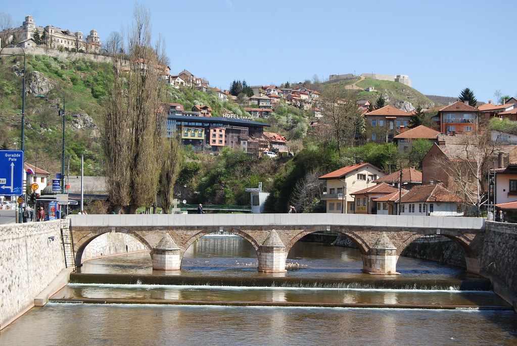
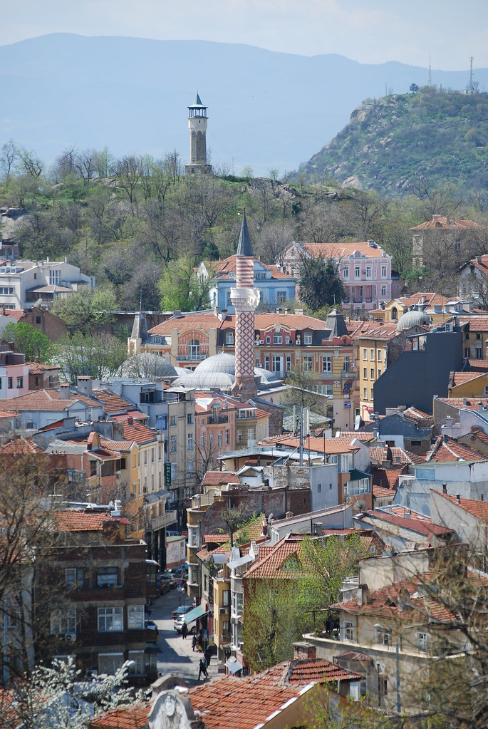
From the seminar in Bulgaria, I traveled by overnight bus through Skopje, Former Yugoslav Republic of Macedonia (F.Y.R.O.M) to Pristina, Kosovo where I had the opportunity to spend the afternoon. As the capital of a newly “recognized” state (by some nations at least), Pristina is in a still-developing form. Shells of under-construction churches, abandoned residences within the old town, and a stalled rehabilitation process at a Haman (Ottoman Bath) were a few visual cues of Kosovo’s trouble separating from Serbia over the last decade. However, a vibrant old town with minarets doting many corners and an economy on the euro is a good sign that there is hope.

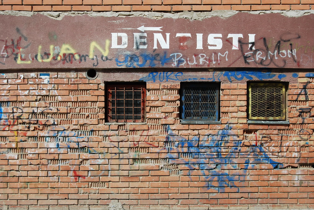
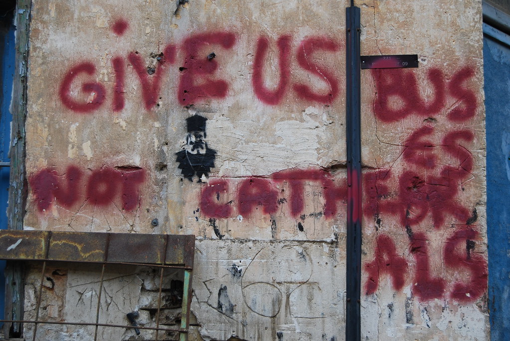
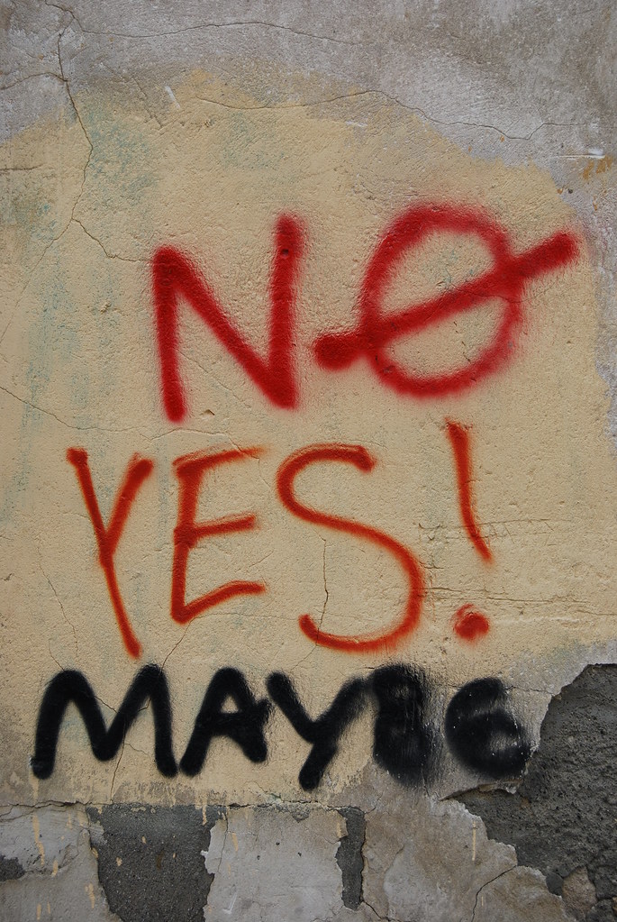
Graffiti on a wall in a housing project in Pristina

The city parks were full of people


From Pristina I took another overnight bus trip to Sarajevo via Novi Pazar. The 11 hour bus ride dropped me at the central bus station at 5am, completely exhausted with three hours to kill until my hostel would be open. This was not nearly as bad as it seems in a city with so much to investigate! I immediately headed to the Miljacka river that runs through the center of town and walked its banks investigating the famous bridges (where WWI began and where the first victims of the Siege of Sarajevo were killed in 1992). By the time I arrived back at my hostel at 8 I had already tasted the diverse urban landscape and found myself ready to explore!

I realized that Sarajevo can be best explained by comparing elements of the city with other places I’ve been: The street life during the day in the city center is comparable to that in Thessaloniki while the marketplace nearby reminds me of a westernized version of Khan-al-Halili in Cairo. The coexistence of religious monuments (mosques, churches of multiple denominations, and mosques line the streets), although not as “holy” or religiously significant, reminds me of Jerusalem. The Miljacka river runs through the center of the city just as in Florence yet Sarajevo is tucked in a valley beneath the surrounding hills like Missoula, Montana. All of this in a landscape that still shows the scars of warfare only 15 years after the Dayton Peace Accords ended the Siege of Sarajevo.

One of many cemeteries of those killed from 1992-1995 in Sarajevo

Latin Bridge in Sarajevo where Archduke Franz Ferdinand of Austria was assassinated with his wife. Where WWI began.

Skyline of minarets, bell towers, and domes

A "Rose" marking a bomb location where a someone was killed.

Sarajevo proved to be an incredibly interesting city full of life and diversity despite the troubles that mark its history.
The owner/manager of my hostel, Jasmina, was born in Dubrovnik, Croatia but came to Sarajevo in 1991 to attend university. Within one year of her arrival she was trapped in her apartment as the city she was just beginning to get to know was being destroyed all around her. After four years of hell, not knowing whether a sniper or a shell would end her life that day, Jasmina has remained in Sarajevo to run a hostel (Enjoy Hostel) and tell her story. Despite all of the adversity she’s faced, I never saw her without a smile on her face. She insisted that her husband drive me and her to the Tunnel War Museum so she could tell me her story. The tunnel was the lifeline of residents within Sarajevo for many years as this 800 meter long hole connected Sarajevo under the airport, which was under the control of UN troops, with the “free area” of Butmir on the other side. Supplies, communication, and soldiers were transported back and forth along this line for years and undoubtedly saved many lives. At the end of the tour, Jasmina brought me outside of the house that the tunnel was built beneath to look at the shelled façade. She pointed to a mark left by an explosive on the ground near the door to get into the tunnel and explained how soldiers would send shifts of 10 people at a time through the tunnel for safety purposes. On one day in May 1994, Jasmina was sent through in the first group of 10 of the 100 waiting… That explosive mark she was pointing at, she explained, was left only five minutes after she was standing there killing a number of those in queue in the group she left behind.

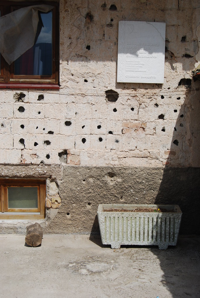
Notice the explosive mark on the ground. The door to the tunnel is on the right.


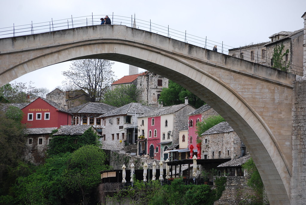
I also took a side trip to the city of Mostar, which had a vibrant Old Town and a UNESCO-monumentalized bridge before the war erupted. In a similar manner to Sarajevo, Mostar was completely devastated by shelling. Since then the city and the historic bridge have been completely rebuilt.


The bus between Mostar and Sarajevo covered a wonderfully scenic route along the river through the mountains.

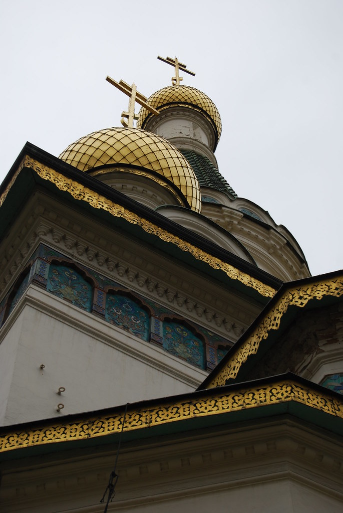
On my final day on this Balkan tour, I boarded a morning train to Belgrade, Serbia in order to have some time to see the city before I flew out that evening. The city was covered in Orthodox churches, a large pedestrian-only city center, as well as a medieval fortification that has been altered numerous times throughout its history and has been largely conserved as a park and a museum.

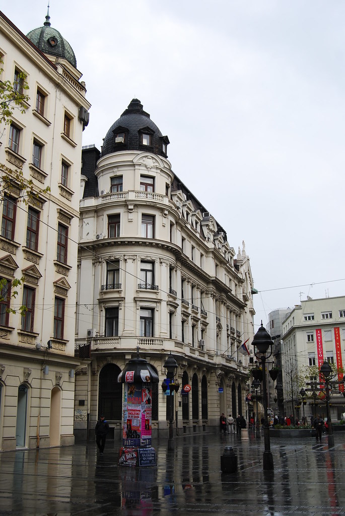
Main pedestrianized street in downtown Belgrade

Belgrade fortification gate


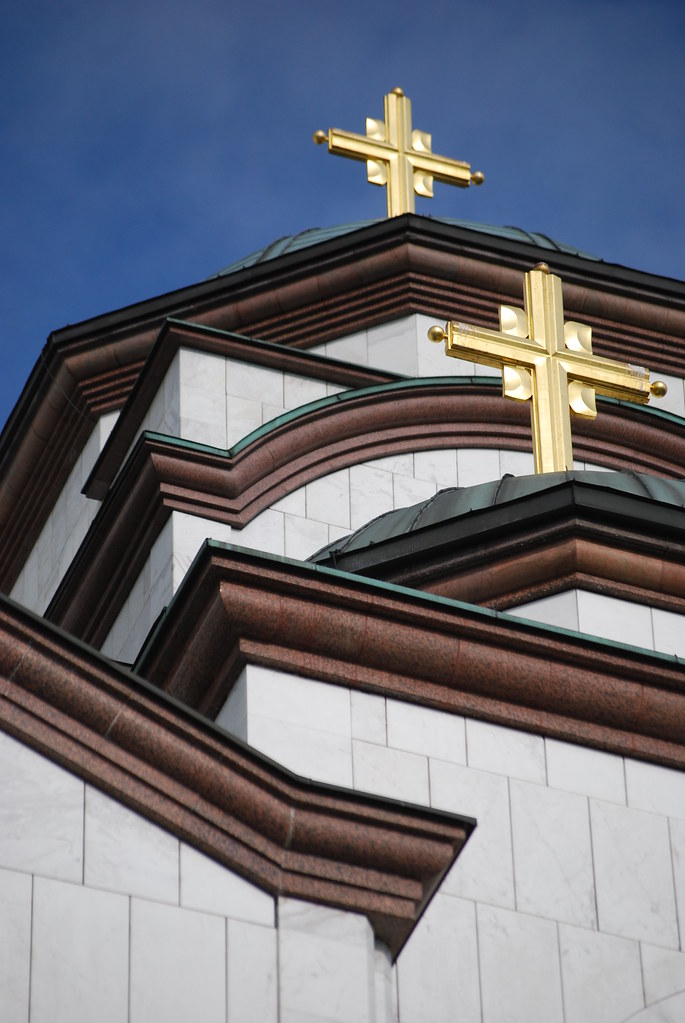
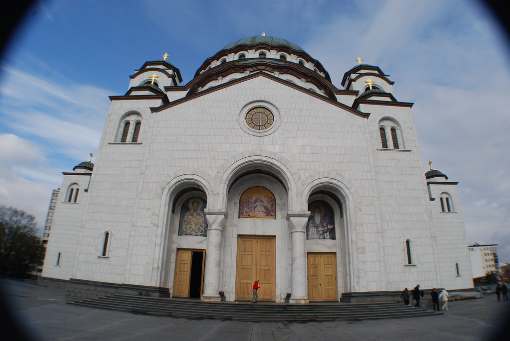
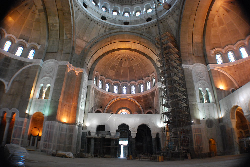
Cathedral of St. Sava is the largest orthodox cathedral in the Balkans and the interior is still under construction. 

Friday, April 15, 2011

Seminar in Bulgaria

From April 6-9 I attended the Fulbright Enrichment Seminar put on by the Bulgarian Fulbright Commission on the topic of “Cultural and Social Integration in 21st Century Europe”. Feeling that my project was related to the topic, I gave a short presentation regarding the “unifying” aspects of architectural heritage that I’ve been finding during my explorations of Nicosia. To be brief, I argued that the substantial funds and development projects that have developed in preparation for Cyprus’ turn as the President of the Council of the European Union in 2012 could be better served saving the rich layers of heritage in the capital rather than covering them up. I felt I received a lot of interesting feedback to move forward with.
However, my favorite part of the seminar was talking with the other students conducting research grants in the region (Balkan, Mediterranean, and Caucas states). As I listened to many of the presentations and talked to the other participants during our downtime, I realized how much more I have to learn about the region. This was only reinforced by my travels immediately following the seminar (see next post).

Although I had seen Sofia, Bulgaria before, this seminar offered another opportunity to explore a few of its important monuments. In addition, we got the opportunity to visit historic city of Plovdiv. The Old Town area, within an originally Roman fortification that only partially exists today, monuments and Ottoman residences that were shown to us by a guide provided for the group who seemed to know about every last detail of the city.

SOFIA


Alexander Nevsky Cathedral in Sofia

Golden onion-shaped domes of the Russian Church of St. Nicholas the Miracle-Maker

Main street in Sofia


PLOVDIV
View of downtown Plovdiv

Rehabilitated Roman theater in Plovdiv

Outside of the main gate of fortification surrounding Plovdiv's old town. Ottoman housing on the outer edge of the city