Sunday, February 26, 2012

Road Trip – Giant’s Causeway, Carrick-A-Rede, & Bushmills


Yesterday, I went on a road trip to the north coast of the island to some of the most famous sites that Northern Ireland has to offer. The excursion began at the Giant’s Causeway where hexagonal-shaped basalt columns formed during the rapid cooling of molten lava in the area over 60 million years ago. The more interesting story is that Irish mythological giant Finn McCool who got into an argument with a Scottish giant (Fingal) across the Irish Sea. After hurling massive rocks at each other but falling short, the not-so-strong swimmer, McCool began to construct stepping stones across the Irish Sea to Scotland. Either story results in a landscape of repeating yet irregular columns that seemingly continue endlessly into the sea. 


The journey continued to the Carrick-A-Rede where a rope bridge has connected Carrick island to the mainland of Scotland for nearly 350 years. The brige itself has of course been replaced and re-replaced since its original establishment, but at 100 feet above the crashing sea through a channel of high winds it is a unique way to experience the Irish coast alongside high cliffs.


The day ended in Bushmills which is home to the famous Irish whiskey distillery named after the town. Bushmills whiskey has been distilled continuously since 1608 and is transported all over the world today.


Thursday, February 23, 2012

Meanwhile Project

A UK wide project entitled "Meanwhile" has begun during the current recession to open up vacant store fronts to be reused by community groups, organizations, and churches at no cost until a new renter is found. This is an important initiative to keep the public realm alive during an economic downturn by encouraging positive community use in areas experiencing high vacancy rates.

The first example of this in Belfast is an organization that I became acquainted with a few weeks ago. The Dock is a non-denominational Christian community and prayer group that are located in the "Titanic Quarter" of Belfast. Development of the Titanic Quarter began just before the recession went into full swing and as a result only a small number of buildings were ever completed. A series of high-end high rise apartment buildings were completed but, unfortunately vacancy rates are still high in the residential units and the commercial ground floor is completely empty. In a place like Belfast where religion has drawn the line between two groups of segregated people for much of their history this non-denominational group is essential to encouraging activity from Catholic, protestant and visitor populations in an area that is defining its own destiny in the coming years. It is hoped that the international/cosmopolitan nature of the Titanic Quarter as a new residential, cultural, and commercial center will provide a shared space for people of all backgrounds to live and interact despite this city's history. Here is a video from the leader of the group sharing his excitement:


Much of the grand plans of the quarter were put on hold due to the economic downturn but the apartments seen above and the signature building, the Titanic Visitor Centre, went forward. The Visitor Centre is due to open at the end of next month with galleries and banquet halls focusing on the history of the Titanic and the importance of shipbuilding in the rise of Belfast. The project is situated immediately adjacent to the original drawing office where White Star lines drew all the plans for their ships which were subsequently constructed in the nearby docks.


Additional videos and renderings of the proposed quarter can be found at the architect's, Eric Kuhne & Associates, website

Although the Harland & Wolf cranes are the most noticeable monuments of the shipbuilding age in Belfast, these are relatively modern supports of the shipbuilding heritage here and they had no part of the early greatness of the White Star Lines. However, as you walk further down the docks area remnants of the original building site of the Titanic still remain as does a war ship from WWII (HMS Caroline) and some infrastructure. 


Before the sun completely set I snapped a photograph of the Thomson dry dock which was the site of the construction for the Titanic. You see it today as it was 100 years ago with the same gate holding sea water out. To give you a sense of scale, the Samson and Goliath cranes are approximately 348 ft. and 315 ft. tall respectively, and the small figure in the left third and bottom of this picture is 6 ft. tall... The titanic would have spanned the complete width across the dock, from end to end, and from the floor of the dry dock to the top of the White Star Lines building in the distant middle. It's impossible to get a true sense of scale from the photograph but it is absolutely massive!

My Portfolio

While continuing my studies here in Belfast I'm simultaneously job searching in the greater Chicago area. As a result I developed a portfolio of my work during the first semester of this year and throughout the past couple of years as well to show employers. The first two projects are based in the 'Liberties' area of Dublin and 'Cathedral Quarter' in Belfast. Please have a look and let me know what you think!


Tuesday, February 21, 2012

Global Classroom

Over the past few weeks I've been a part of a 'global classroom' where students and faculty focused on urban issues in contested space from three areas meet regularly via video conference to discuss the issues each place is facing. Groups from here in Belfast, Chicago and Pretoria, South Africa have met three times in the past few weeks to briefly introduce the unique urban conditions found in each city, specifically as it relates to historically rooted sectarian division and racial or ethnic segregation. More information about our conversations and efforts can be found at this blog address.

Saturday, February 18, 2012

Amsterdam


Last week I took a short trip to Amsterdam with a friend who came to visit from the US. The city is geared entirely for pedestrians, cyclists and... boaters with a complete canal system running throughout the Netherlands capital. While we were there the canals were completely frozen over, but this provided for a different method of transportation - ice skates. Instead of taking the recommended canal tour by boat we were able to walk withing many of the canals and take pictures of the intimate side streets and thinly sliced townhouse buildings that line the waterways throughout the city.


The public transportation system throughout the country is robust, and Amsterdam provides visitors and residents alike ultimate mobility with a train, tram and bus system that services all of the radial city. The photo below captures the dreams of many designers and planners of pedestrian-friendly urban centers. Public transportation and pedestrian movement take up the majority of the street, while local traffic with cars and maintenance vehicles are allowed a few lanes to the side. The density of Amsterdam allows this scheme to function, but the Dutch are also known for their eco-friendly mindset and love for cycling. Which came first - The policy, design or mindset?


Bicycles are so prevalent that there are designated lanes for riding them throughout the city and multi-story bike parks (not car parks) can be found near main transportation hubs and high traffic areas. Any railing along a canal is also covered completely by parked bikes.


Of course there are other aspects to the city that won't be mentioned in a venue as public as this blog. Without going too much further, Amsterdam is the European Sin City. Despite this underground, seedy claim to fame it is a city full of intimate streets along lit bridges and canals with quaint restaurants as well as grand squares. Contemporary dutch architecture is also quite pleasing and is often conscious of the historic urban fabric surrounding it.

Wednesday, February 15, 2012

Do Walls Make Good Neighbors

Sorry for the lack of posts over the past week. A good friend from college made a trip to Belfast and I spent the last week and a half exploring with him in Northern Ireland and Amsterdam. Pictures will follow in the next few posts.

In the meantime, I stumbled across the following video which is attempting to provoke a discussion on the continued use of peace walls to separate communities. It's called "Do walls make good neighbors?".

Sunday, February 5, 2012

A Common Battle

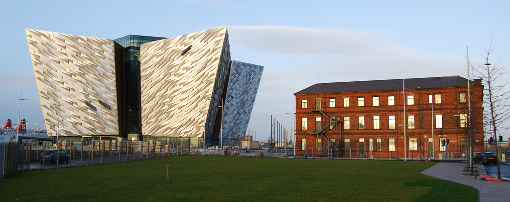
For the past few months I’ve posted time and time again about the murals and ‘peace walls’ that still exist to this day throughout Belfast. Each relic from this divided city’s past express a distinct rift in the landscape between groups of people, separated by a seemingly irrelevant concrete wall at the edge of a sidewalk or concentrated around a rallying cry from past generations against their neighbors. This all seems unbelievable at first as an outsider walking or riding through on a tour bus… But as much as these tourist groups ride through the infamous neighborhoods of the troubles, the underlying tension around sectarianism remains. Violent crimes between groups are low (except for rioting during certain parts of the year), but the insular community feelings and fear of neighboring communities remains high in working class communities where the large welfare system seemingly can’t revive the vibrancy each had before the division nor does tourism assist in that effort. The groups remain marginalized and new generations are born into the continuous cycle of poverty.

Does this sound familiar? Maybe not to all of us, but consider how major American centers operate. Within the core of Milwaukee, Detroit, St. Louis, Chicago, Minneapolis, New York, Los Angeles, etc. pockets of ethnic minority and distinct socio-economic class have gathered into ghettoized communities, which were often the first to be marginalized further by government intervention (Highway systems, public housing projects, poor education systems, waste facilities, etc.). Jerusalem, Sarajevo, Nicosia, Belfast are names synonymous with conflict and tragedy between groups of people, but how is Chicago or New York any different? The gang and drug related battle over territory continues in many of these cities as a result of a cyclical process of feeling marginalized, disadvantaged, underserved, misrepresented by the media and misunderstood by authorities.

It’s often extremely difficult to understand how violence among people with tremendous similarities and communal interest in a place could continue. How could neighbors harvest such strong hatred for one another and wage war against each other in their own backyards? But consider it in another context, many of these marginalized groups felt unprotected and/or unrepresented by the government or police structure to protect themselves. They band together in an armed struggle which easily grows through the support and recruitment of others with similar feelings while exploiting the importance of armed defense as the only remaining option for retaliation. It happened to children like the one pictured below in Belfast in the early 1970’s as teens became the foot soldiers of paramilitary activity.

This picture of a 3.5 year old is utterly disturbing (Photo from the Belfast Telegraph)

To sum up, my interest in the communities around Belfast and other divided cities is not a sick obsession with “Dark Tourism” or conflict. Instead I’m interested in understanding how, as a designer and an advocate for a communities well-being (economically and socially), I can help rebuild relationships with these under-served populations to gain their trust and provide them with a built environment they are truly proud of using; public space that is truly shared space and provides social and economic benefit to a community for its vibrancy. A reward for communities who can move past their differences with their neighbors to benefit all sides involved.

Wednesday, February 1, 2012

Divided Cities in NY Times

A recent opinion article of the New York Times Looks at cases of of a few divided cities (past and present) throughout the world including Laredo, Texas/Nuevo Laredo, Mexico; Berlin; Nicosia; Jerusalem; Valka, Latvia/Valga, Estonia; and Mitrovica, Serbia/Kosovo. Numerous others come to mind in more or less literal senses (neighborhoods in New York and Chicago, Beirut, many Bosnian cities, neighborhoods in Belfast, Korea, etc.). I found the opinion article to be biased and over generalized, suggesting that, in the case of Berlin, the almost complete dismantling of the wall and building of Potsdammer Platz in it's place represents that the city has moved forward from division simply by building over the past. Meanwhile, it was difficult for him to see Jerusalem ever being a capital of two states due to the severe 'extension of Isreal's security' when in fact the line represents the one drawn and recognized internationally to protect the sovereignty of two people...

I've booked my ticket to visit Berlin for the first time in Late February and I am looking forward to analyzing how this city moved past its previously divided self.