Monday, November 28, 2011

Murals of Newtownards Road


Immediately adjacent to the Short Strand neighborhood is the Loyalist community along Newtownards Road. This area was the site of numerous days of violence over the summer during riots. There is a high density of murals in the area that say "Lest We Forget", referring to atrocities that were committed against the community by the IRA.


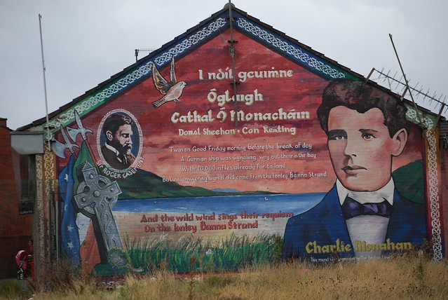
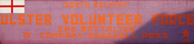
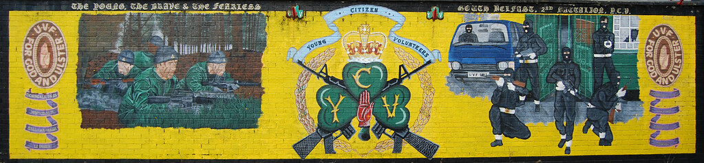
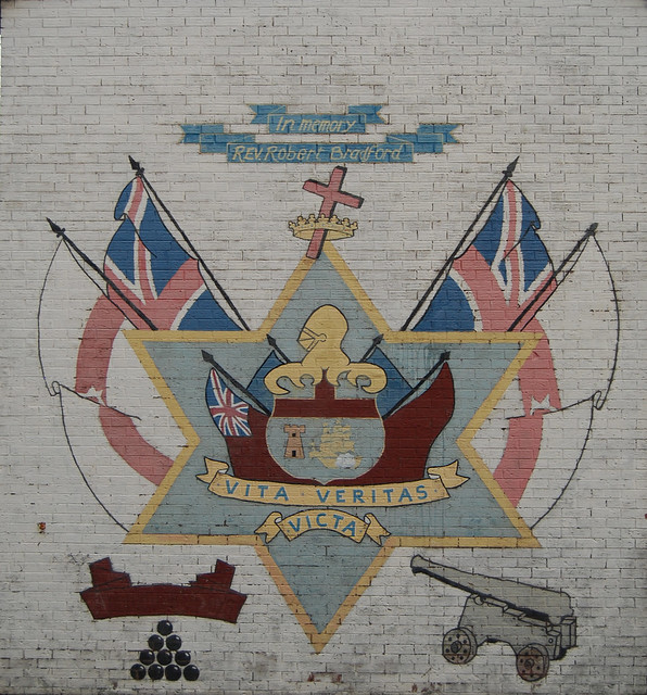
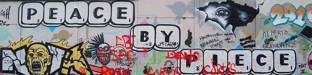
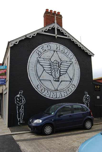
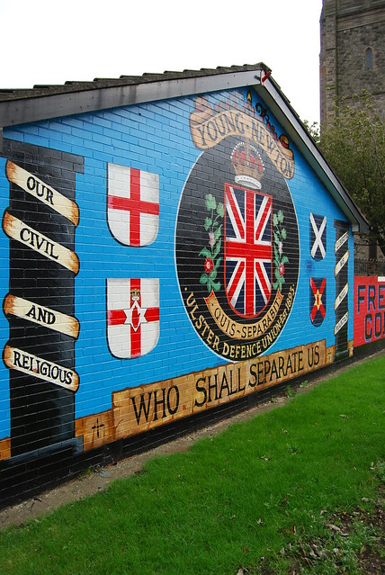
As seen in other Loyalist areas like Shankill Road or Sandy Row, the "Red Hand of Ulster" is a prominent symbol of Northern Ireland. Even the rugby team of Ulster has the Red Hand as their team symbol. Unfortunately, this symbolism has become synonymous with Loyalist paramilitary groups, namely the "Red Hand Commando's" who controlled this area of East Belfast.


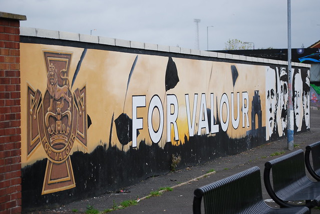
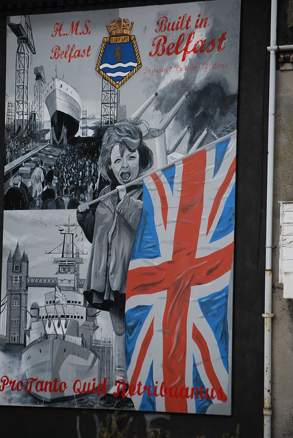
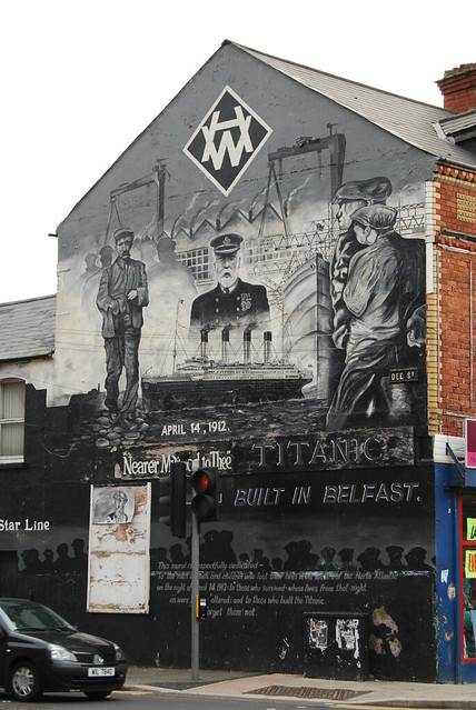
Additionally, many of the area's murals relate to the industrial, working class population that has lived in this area for well over a century. As you can see in the image below, the shipbuilding harbor is very near to this neighborhood and many former employees of Harland & Wolff would have lived and worked here. They've shown their pride for their industrial past on the walls in the area as well.


Sunday, November 27, 2011

Murals of Short Strand


Immediately east of the Lagan River and south of the industrial port district is an area known as Short Strand. This social housing complex is inhabited by primarily low-income Catholic families adjacent to a loyalist community along Newtownards Road, which I will show you in my next post. The first sign that this neighborhood is Republican can be scene on the entrance gate pictured above, where English and Irish are side by side.


A community center, sports facilities, and a youth empowerment scheme seem to be efforts to move the residents of this neighborhood in the right direction, but the facilities are run down and the area remains isolated between Loyalist communities and multi-lane roads. 


Politically motivated murals cover walls around the housing complex supporting the vote for a Sinn Fein and the paramilitary organizations that once controlled the area.


Murals of peaceful times and atrocities committed against the population can also be seen on the walls. The Palestinian flag in the image below represents the nationalist feeling that British control over the north is an occupation, just as Israel is to the Palestinian territories.

Friday, November 25, 2011

Spuds

An article in the New York Times today described the new effort to revive the potato as an essential element of Irish dishes. Apparently pasta, rice, and other alternative starches to the spud are becoming more acceptable in the contemporary Irish meal... TRAITORS! 

As many of you may know, the potato left its mark on Irish history during the "Great Famine" during the mid-19th century. A potato disease spread across Europe, but none were hit harder than the spud-dependent Irishmen/women. Approximately 1/3 of the population was completely dependent on the crop when the famine hit, which led to nearly 1 million deaths and a mass emigration of another million (many came to the US during this time).

Despite the article's suggestion that potato consumption was down nearly 25% on the island in recent years, I can't imagine eating more potatoes at a given meal than I already do! Every time I've been out to eat there are AT LEAST two types of potatoes on the table (chips (fries), mash, baked, boiled, fried, etc.)... Don't get me wrong, I love my spuds (and they prepare them well here), but some diversity never hurt anyone!

Wednesday, November 23, 2011

Murals of Donegall Pass

Here are a number of murals from another Loyalist neighborhood in South Belfast along the west bank of the Lagan River. These paintings were found immediately off of Donegall Pass and many contain UVF slogans or make reference to historic ties between Ulster and Great Britain.


Monday, November 21, 2011

Carrickfergus (cont.)

Outside of the castle in Carrickfergus there is a small town center that was once surrounded by a wall as well (remnants can still be seen to this day). However, most of the attention in the town is directed to the harbor area surrounding the castle. It has become more of a fishing harbor from what I could tell, but it retains some of the cities former industrial charm as well.


Inland from the harbor there is a dual carriageway (or country road) that cordons off the castle and harbor from the town center. This happened to a number of villages in the 1960. Unfortunately that has limited the potential of the town center as a tourist draw and there is little to see. I found a number of very old grave stones in the cemetery surrounding St. Nicholas Church, however.

Many other grave stones were wrought iron like this one, but others were stone and some dating back into the 18th century.

Saturday, November 19, 2011

Carrickfergus Castle


Yesterday I took a short trip by train to the town of Carrickfergus, which is approximately 12 miles northwest of Belfast. The city is the oldest town in the county (Antrim) and is one of the oldest settlements in Northern Ireland as a whole. Following the most recent Royal Wedding, Prince William was bestowed the honor of becoming Baron of Carrickfergus.

An Irish folk song entitled "Carrickfergus" recorded by Van Morrison 

The town is visited today primarily because of the castle along its shores. As the oldest surviving Norman fortification, the rocky outcrop in Belfast Lough was established in the late 12th century. Two additions to the castle over the following centuries further fortified the castle which underwent numerous sieges in its history. More recently the castle was used as an air raid shelter during WWII as a German Blitz descended on Belfast. Until the end of WWII the castle was under control of the armed forces before finally being transferred to the Department of the Environment who now controls it as a monument.


Former walls and bastion of the second building phase of the castle. A natural fissure between the left side of the photo and the new addition to the right had existed until it was filled to extend the castle inland.


Unfortunately, the castle is set up mostly as a children's history lesson, which detracts immensely from the grandeur of this important site. As you walk around the site there are numerous mannequins who represent historical figures who used the castle and the introductory videos to the history of the site is a cartoon reenactment of the sieges. In addition, many of the walls within the keep have been painted over with scenes of what life might have been like during certain periods of history. I was pleased to see that a class from a local school was touring the facility, but I thought the exhibition was poorly done and cheapened the importance of the castle. A £4 entrance fee didn't help either...


Friday, November 11, 2011

Shankill Butchers Gang

A disgraceful and extreme case of violence for which the Shankill is most widely known is that of the infamous "Shankill Butchers Gang". Over 30 people died in the 1970s by brutal attacks that usually included the slicing of the victims throat in a brutal manner with butcher knives. The gang specifically targeted Catholic men and most often caught their victims as they walked home from a night out in North Belfast. There was no other reason for their killings than that they were Catholic...

Interviews from some involved can be seen from 0:30 - 1:31

In total 12 men were said to have been involved in the group of killings but it took nearly a decade for a proper case to develop against them for conviction. In the end all of the men were jailed or killed by the IRA. However, one of the clauses in the Good Friday Agreements was that all persons jailed for crimes of sectarian violence during the troubles were released and eight of the original gang (not to mention the hundreds of other criminals) have been free to live among the general public for years now.

On multiple occasions a black taxi was seen escaping from the scene, and the area now promotes "Black Taxi Tours" from the origin of the attacks through the areas most notoriously associated with the troubles. Main stream paramilitary organizations during those times cut all ties with the vicious acts committed by this group and made it clear that they were extremists, yet the neighborhood remains scared by their actions.

If you have the time, a BBC documentary on the gang can be seen here

Interface Wall at Cepar Way


At a number of areas between neighborhoods of different religious identity in Belfast Interface Walls or Peace Walls have been built. They are intended to protect the neighborhood from violence since the gate is closed after curfew is called in the evening. Gated community has been taken to a different level in this city. Despite the fact that violence has subsided from the high levels during the troubles, many of the walls remain as a security measure for the communities they surround.


One of the most famous "Peace Walls" lies at the interface of the Falls and Shankill roads on Cepar Way. As you will see in the images below, the entire length of the wall is completely covered in graffiti and murals. However, these paintings are much different than the ones I've shown previously in that they display messages of peace rather than nationalist memories or propaganda. It's become such a popular place that black taxi tours and even the open top, double decker buses stop here along their tour. Many people sign the wall or at least take pictures in front of it.